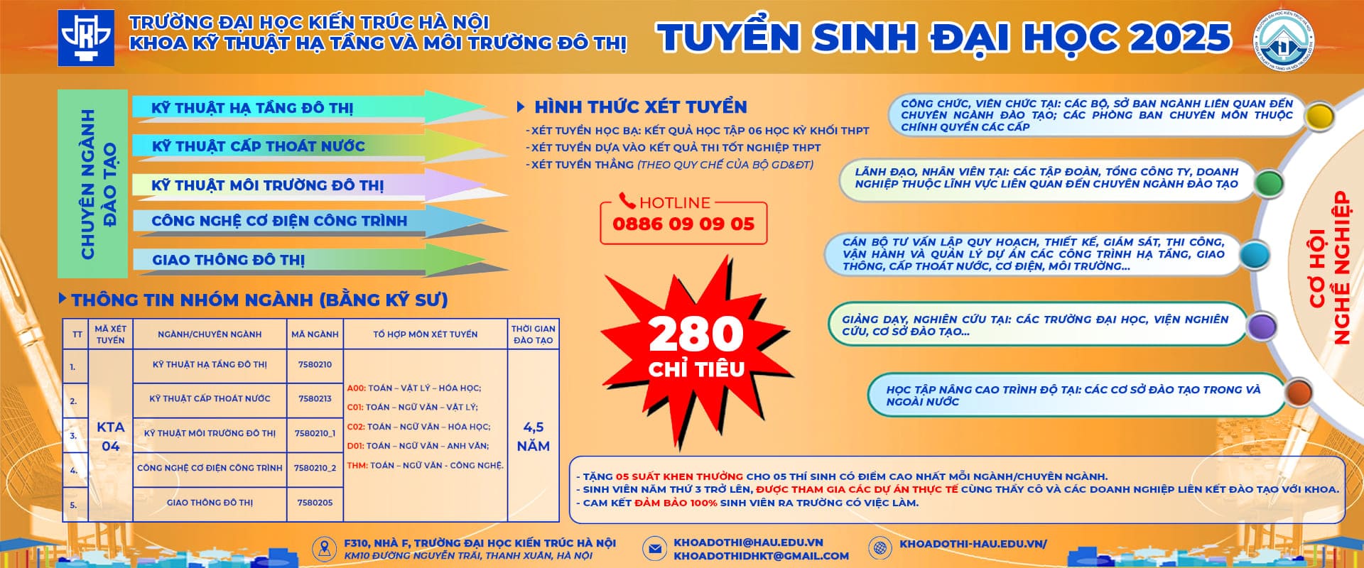
On the morning of March 5, 2024, in Pleiku City, CTECH Hight Technology Joint Stock Company – a member company of S-Group Vietnam – in collaboration with the People’s Committee of Pleiku City, organized a conference to deploy the Urban and Construction Planning Database (CSDL) Software System for Pleiku City. This event is part of the project to build a management and urban planning information system applying GIS technology, laying the foundation for the development of a smart city in Pleiku.
Attending the conference, representing the People’s Committee of Pleiku City, were Mr. Phạm Thế Tâm – Head of the Urban Management Department of Pleiku City, as well as officials and specialists from the Urban Management Department and various wards and communes in the city. Representing CTECH High-Tech company were Ms. Trần Thu Hà – Head of Project Development of S-Group Vietnam, along with other specialists.
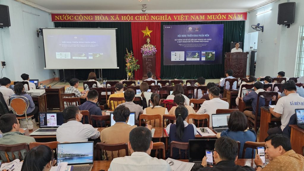
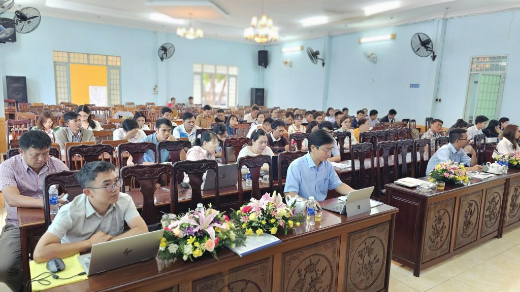
A large number of specialists attended the conference to learn about and utilize the database system.


The construction planning and urban planning database system of Pleiku City, developed, upgraded, and updated by CTECH, is accessible at the website: https://pleiku.cgis.asia/. The system is optimized for web-based operation, compatible with all internet-connected devices, ensuring convenience in searching, retrieving, analyzing, and managing construction and urban planning information.
The platform integrates map layers based on the national geographic system with national reference and coordinate systems. Citizens can access planning information using tools such as location-based search, address lookup, coordinates, planning types, and administrative areas.
Publicly disclosed construction planning information includes land-use functions, area, construction density, building height, legal maps, explanatory reports, and approval decisions. The system encompasses general to detailed planning, with planning criteria as a basis for project development and construction permit issuance displayed according to detailed planning at the proposed location.
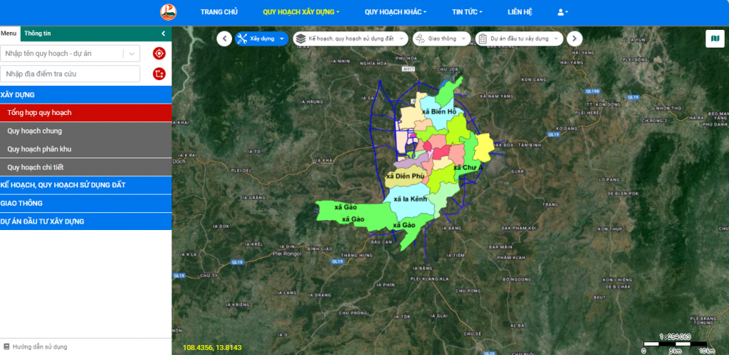
The system is optimized for web-based operation, compatible with all internet-connected devices, ensuring convenience during information retrieval.
A notable feature of the construction and urban planning database system of Pleiku City, developed by CTECH, compared to other models, is the enhancement of a Monitoring and Management of Construction Changes feature through remote sensing image analysis.
The advantage of remote sensing data lies in its multi-temporal, multi-spectral, multi-resolution capabilities and its extensive coverage of large study areas. This method is used to monitor natural geographical surface changes in general and shoreline changes in particular. By applying Geographic Information Systems (GIS) to integrate socioeconomic, transportation, and population data with geographic layers using remote sensing methods, decision-making in construction is optimized while providing the most accurate and visual monitoring of construction changes.
Additionally, the system now offers a mobile application. Users of iOS and Android devices can search for “GIS Pleiku System” in their app stores, download, and install the app to access construction planning information on their mobile devices.
Currently, the “GIS Pleiku System” has also been integrated into the “Pleiku Online” application, which provides updates, connection channels, and two-way communication between citizens and city authorities.
It is evident that the construction planning database system represents a modern approach to planning management, involving the participation of all stakeholders, including citizens, businesses, and government agencies.
Simultaneously, the system fosters transparency by providing public access to construction planning information for citizens, businesses, and investors. This promotes high consensus in developing a smart, sustainable, and green-growing Pleiku City. Consequently, it enhances information technology application indexes and ICT indicators for Pleiku City in particular and Gia Lai Province in general, thereby accelerating the digital transformation process.